Attribute & Classification
🌈 Guides on creating class attributes and classifications.
Attribute
In ontology, an attribute refers to a property or characteristic associated with a class or an instance. For further explanation of the concept, please read our Term Dictionary.
When creating a class, it is essential to add attributes to it.
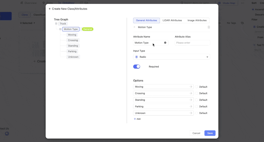
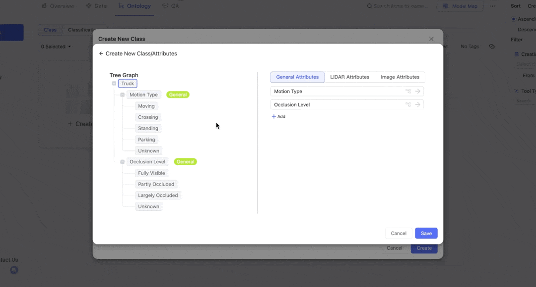
The image below on the left shows the interface for attribute management. The left panel displays the structure of attributes and options, while the right allows you to apply specific settings.
For
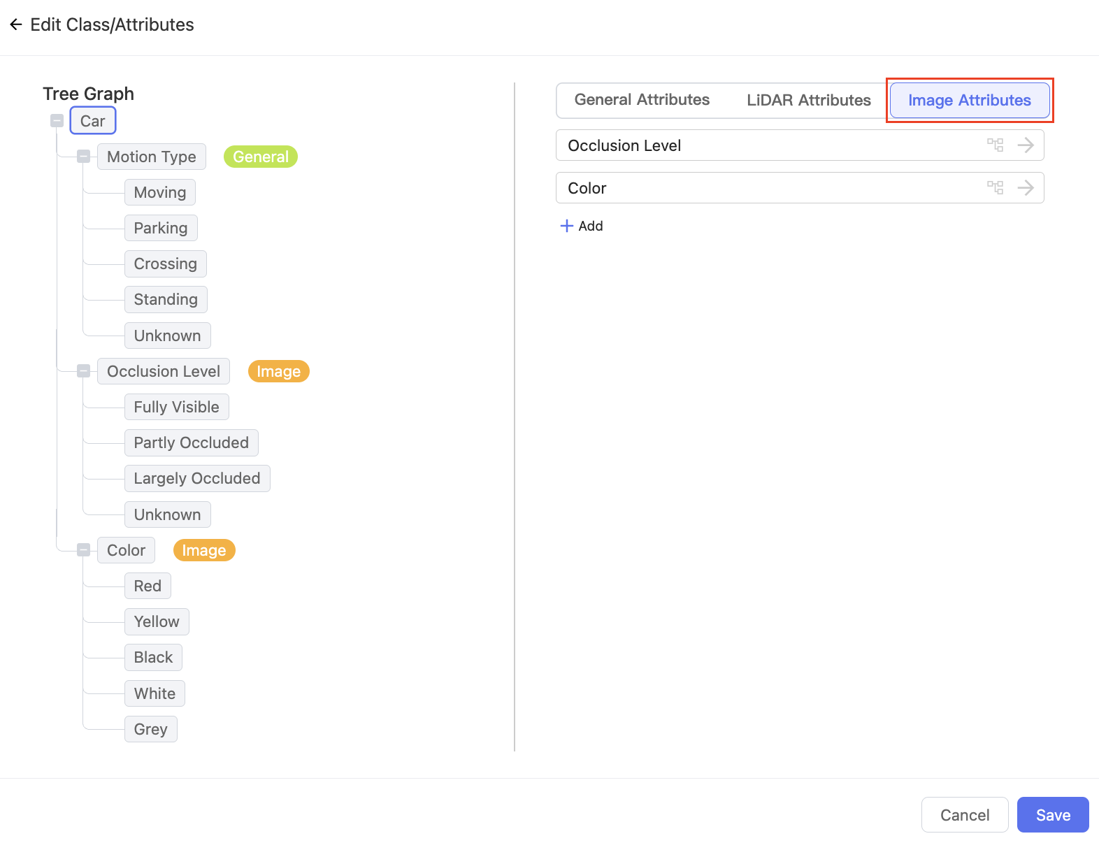
LiDAR Fusiondatasets, attribute directories are displayed at the top right. You can configure them separately to meet different project requirements. Please refer to the Attributes for LiDAR Fusion section for details.
The right image below demonstrates how class attributes appear in Tools.
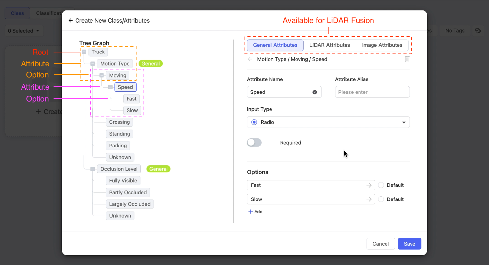
Configure class attributes in Ontology
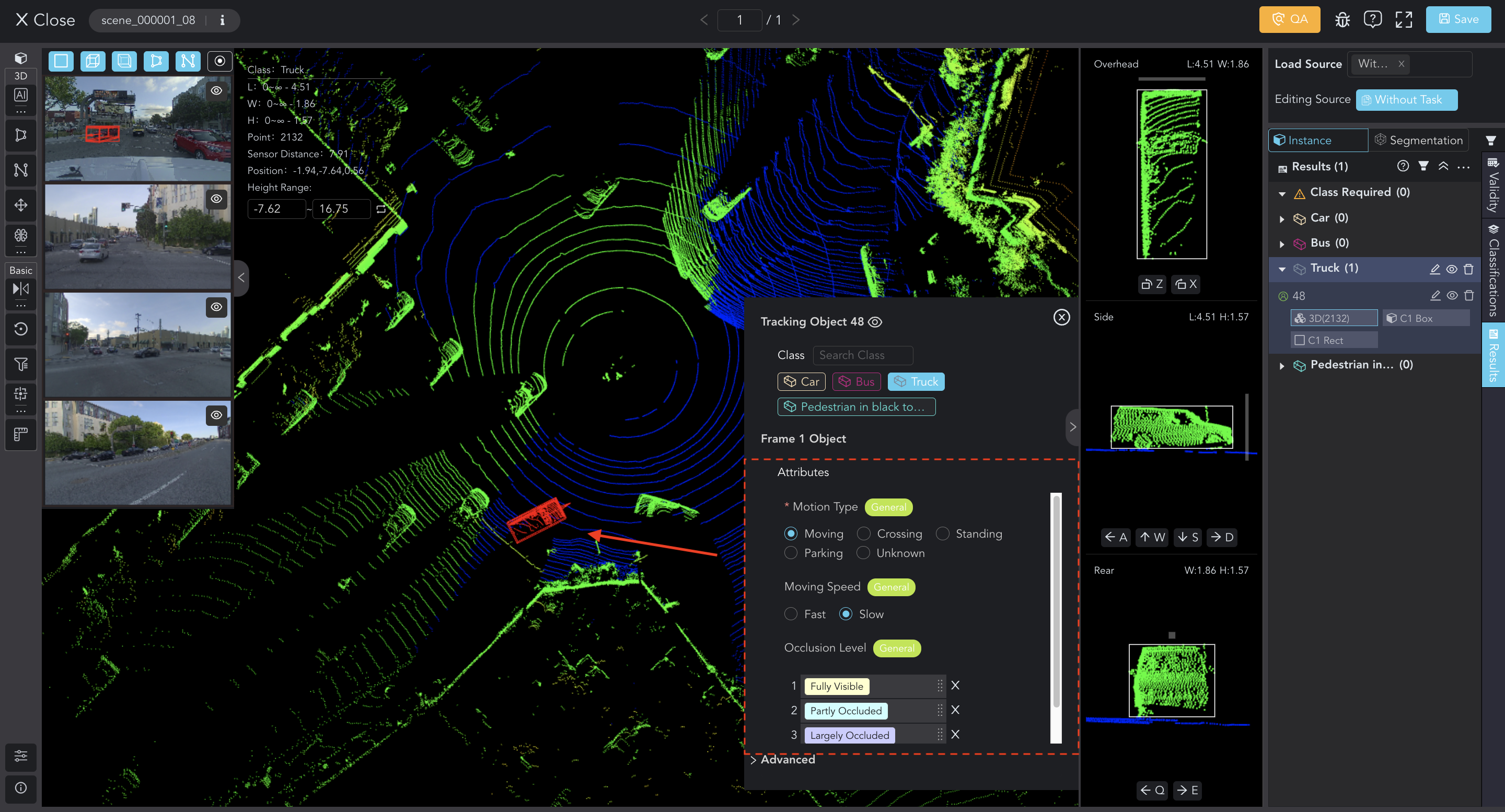
Assign class attributes in tools
'Attribute Names' are more like the questions you want to ask annotators, while 'Options' are the responses they provide.
For example, when labeling a truck, the annotator will select the option "Moving" for the attribute "Motion Type."
If additional details about "Moving" are needed, nested attributes should be set for this option. The annotator will indicate whether the speed of the vehicle in motion is "Fast" or "Slow". (as shown in the images above)
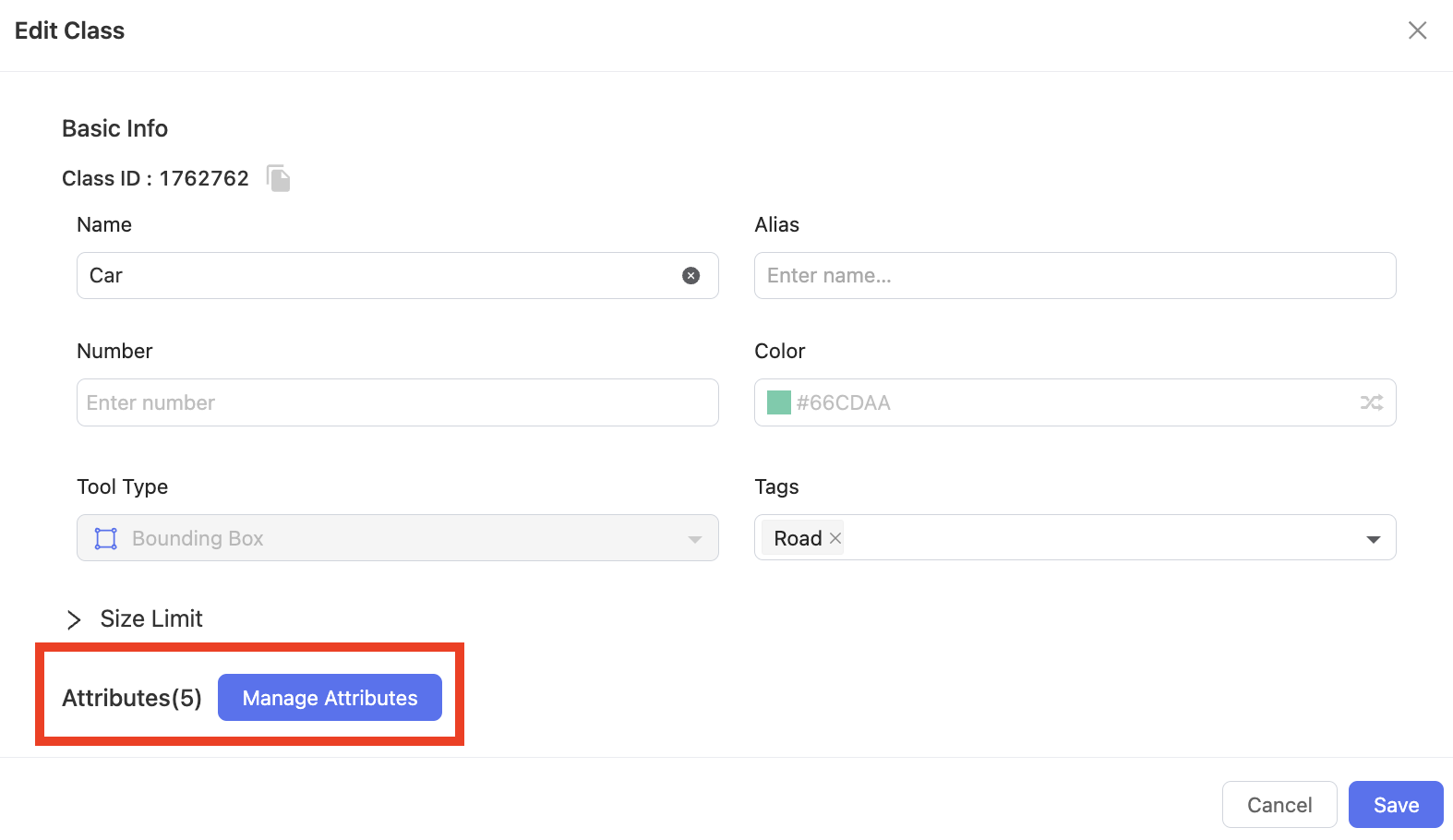
Manage Attributes
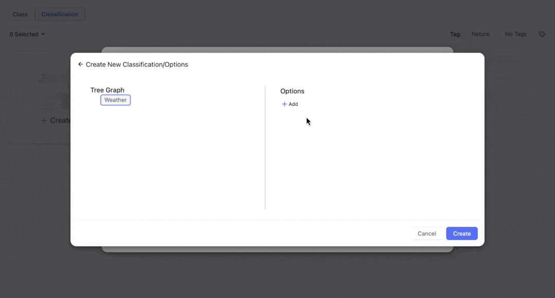
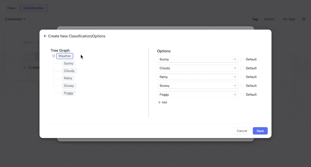
In the beginning, there is only a "root" (the class). Click + Add to add a new attribute and name it. Press the key Entr or click the ✓ icon to enter the configure page.
- Name and Alias: Enter the name (required) and alias (optional) for the new attribute. Please follow the rules consistent with the Class's.
- Input Type: Select the appropriate input type for the attribute.
- Required: You can switch on the
Requiredoption to ensure that annotators provide the necessary information. - Options: Click
+ Addand name options. You can optionally set one of them as default.
Don't forget to include options, otherwise, annotators can NOT set the necessary attributes for the class.
Click the ← button to return. Similarly, you can create and configure other attributes.
Clicking on the attributes and options in the tree graph enables quick access to their respective settings pages.
Additionally, BascAI supports multiple levels of nested attributes, which can enhance metadata during annotation. Select an option in the Tree Graph, and add attributes and options.
After setting up, remember to click Save and Create.
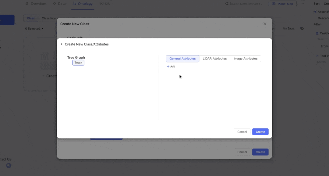
Attributes for LiDAR Fusion
LiDAR Fusion datasets combine 2D images with 3D LiDAR data and possess intricate attributes. In BasicAI, these attributes are classified into three categories:
General Attributes refer to attributes that can be derived from both LiDAR data and 2D images. For example, the general attribute Motion Type of the class Car is observable in both the image and LiDAR data.
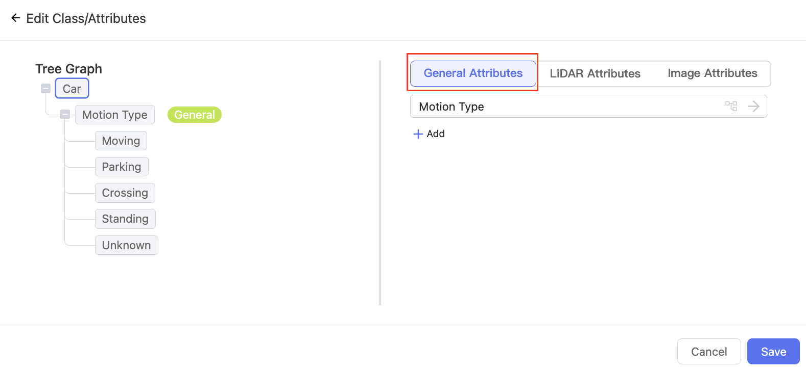
LiDAR Attributes refer to attributes that can only be derived from LiDAR data, such as spatial location and speed.
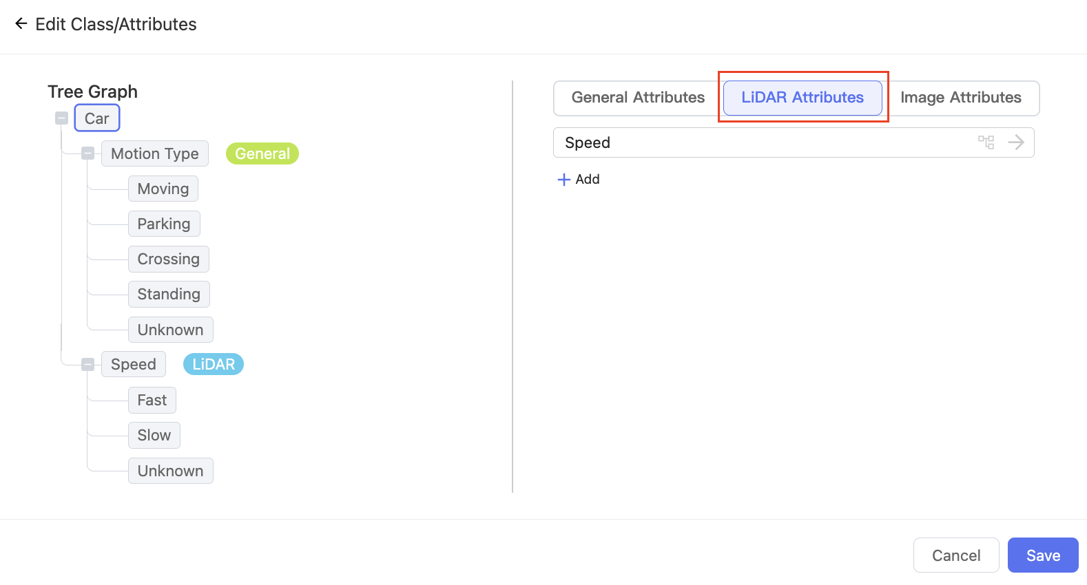
Image Attributes refer to attributes that can only be derived from 2D images, such as colors. Furthermore, the options for these attributes may vary when the same LiDAR object is mapped to multiple images. For example, options for the attribute Occlusion Level differ in each image because of varying angles.
For detailed information on configuring attributes and options, please refer to Manage Attributes.
Preview in Tools
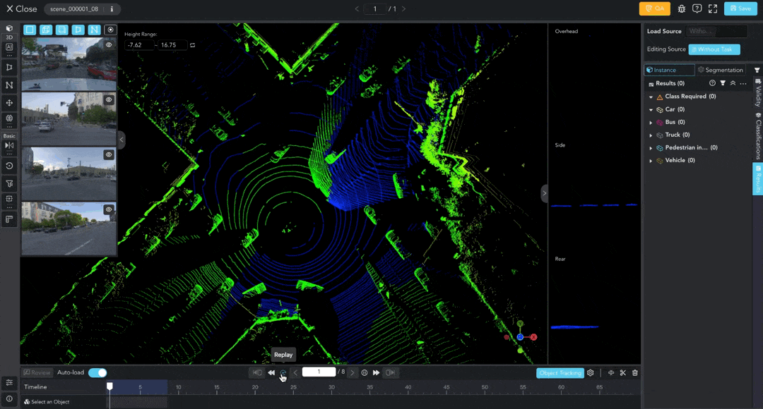
On the Tool page, annotate LiDAR data and provide information for the Class, General Attributes, and LiDAR Attributes. The annotations will be mapped to 2D images.
Double-click to enter the image annotation interface, where you can set the Image Attributes for objects. The attributes for each image data are independent of each other.
Tips: Press the shortcut key T to show/hide class and attributes pad.
Classification
A classification refers to a special attribute that targets the data or scene itself. For further explanation of the concept, please read our Term Dictionary.
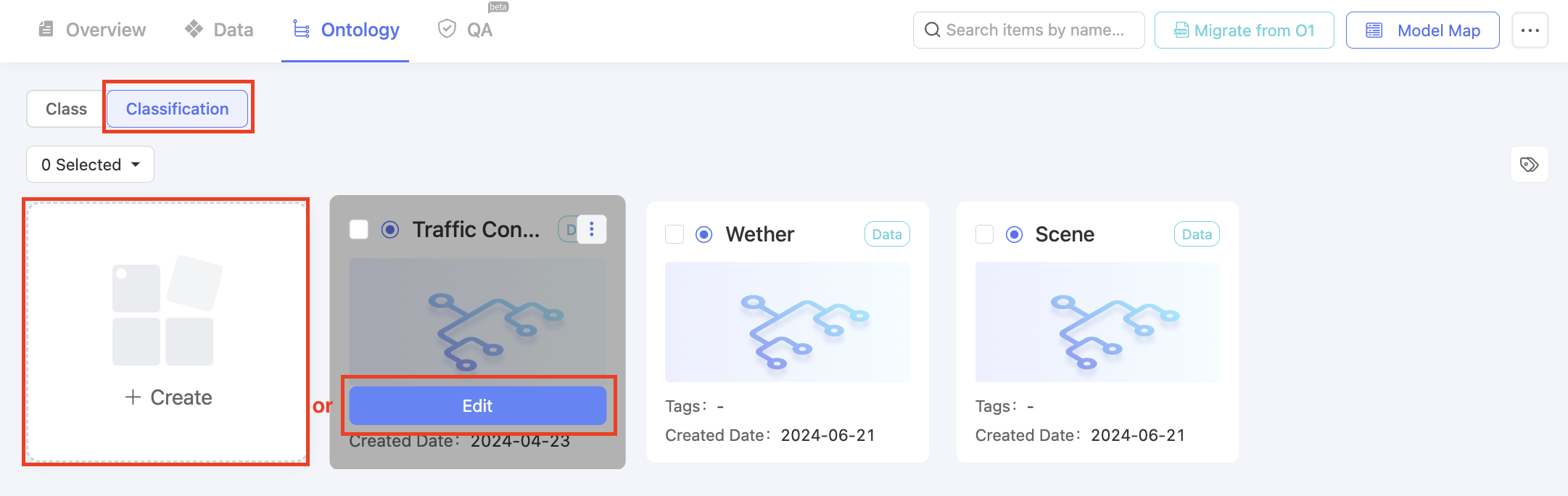
Go to the Classification category. Click the + Create button to configure a new classification, or Edit an existing one.
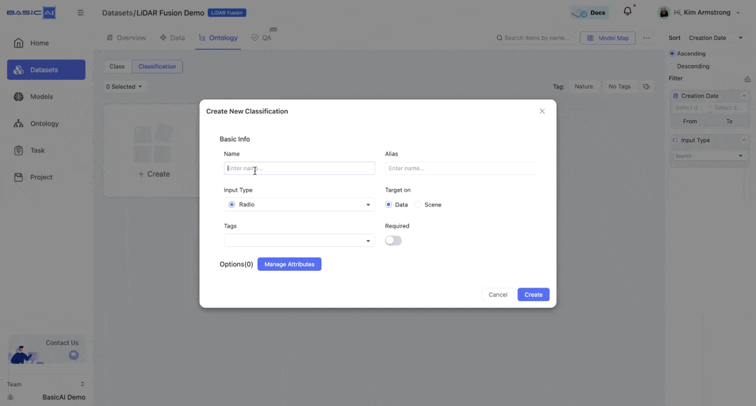
Configure Basic Info
- Name, Alias, Tags, Classification ID are similar to those for Class.
- Input Type: Select the appropriate input type for the classification.
- Target on: You can choose to apply this classification to individual Data or Scene.
- Required: You can switch on the
Requiredoption to ensure that annotators provide this classification.
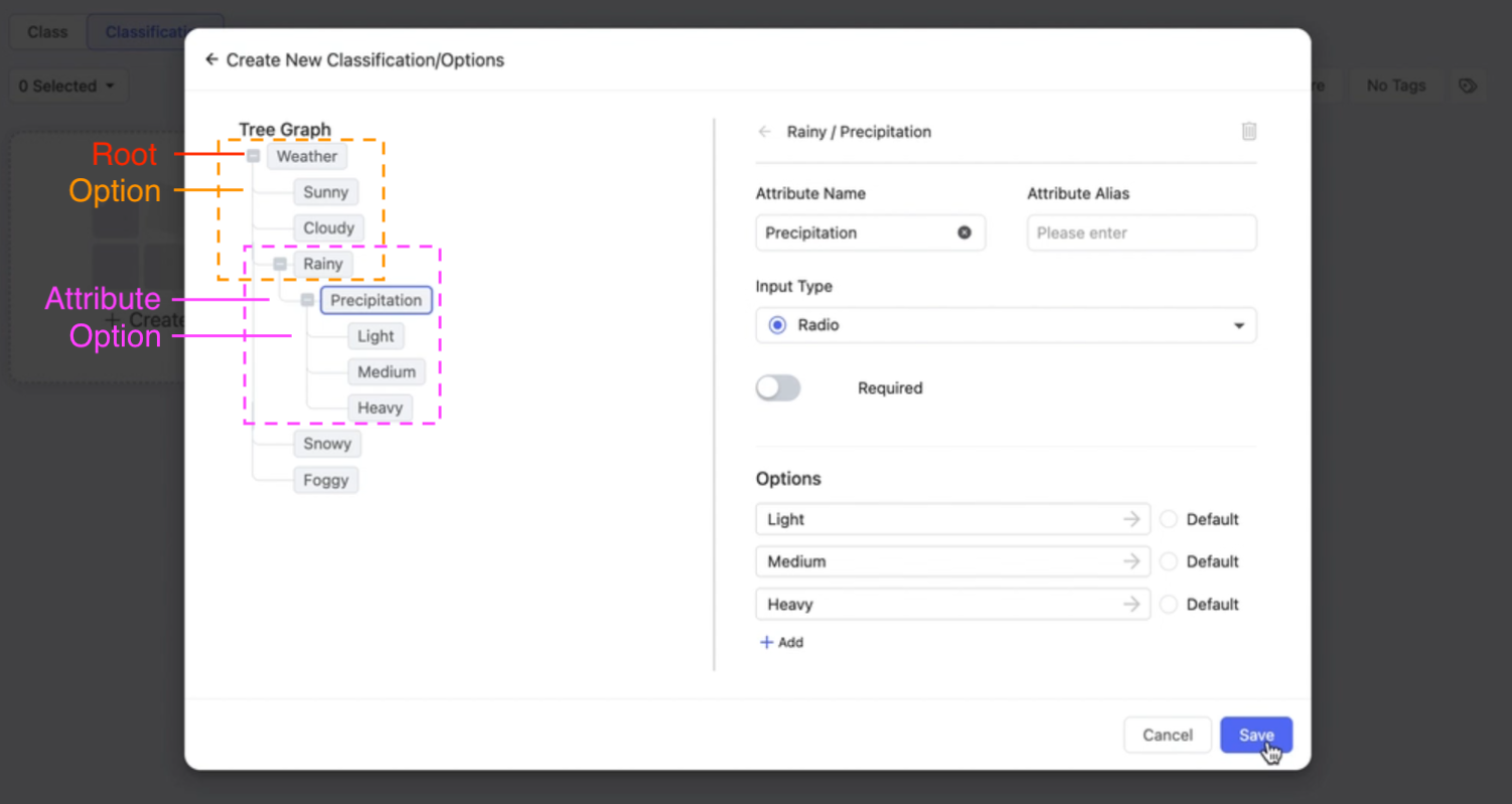
Manage Attributes
The attributes interface is similar to that of classes. The left panel displays the structure of attributes and options, while the right allows you to apply specific settings.
A demonstration of how classifications appear in Tools is shown in the right image below.
Attribute management interface
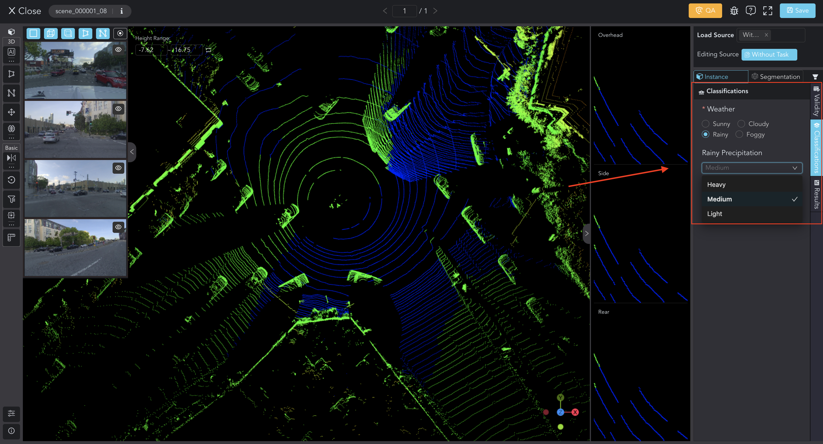
Preview in Tools
However, for classification, a special attribute that targets the data or scene itself, you can add options directly to the root. Click + Add and enter the name.
Still, you can create multiple levels of nested attributes.
Select an option in the Tree Graph, and add attributes on the right panel. Set up the Name, Input Type, Options. Remember to save.
Updated 10 months ago