PandaSet Format Conversion
How to use Pandaset on BasicAI Cloud
In this guide, we'll explore the seamless integration of PandaSet dataset with BasicAI Cloud platform for efficient data management and data annotation in your AI projects. Let's dive in and unlock the true potential of your data-driven endeavors!
What is PandaSet?
PandaSet aims to promote and advance research and development in autonomous driving and machine learning. The first open-source AV dataset available for both academic and commercial use, PandaSet combines Hesai’s best-in-class LiDAR sensors with Scale AI’s high-quality data annotation.
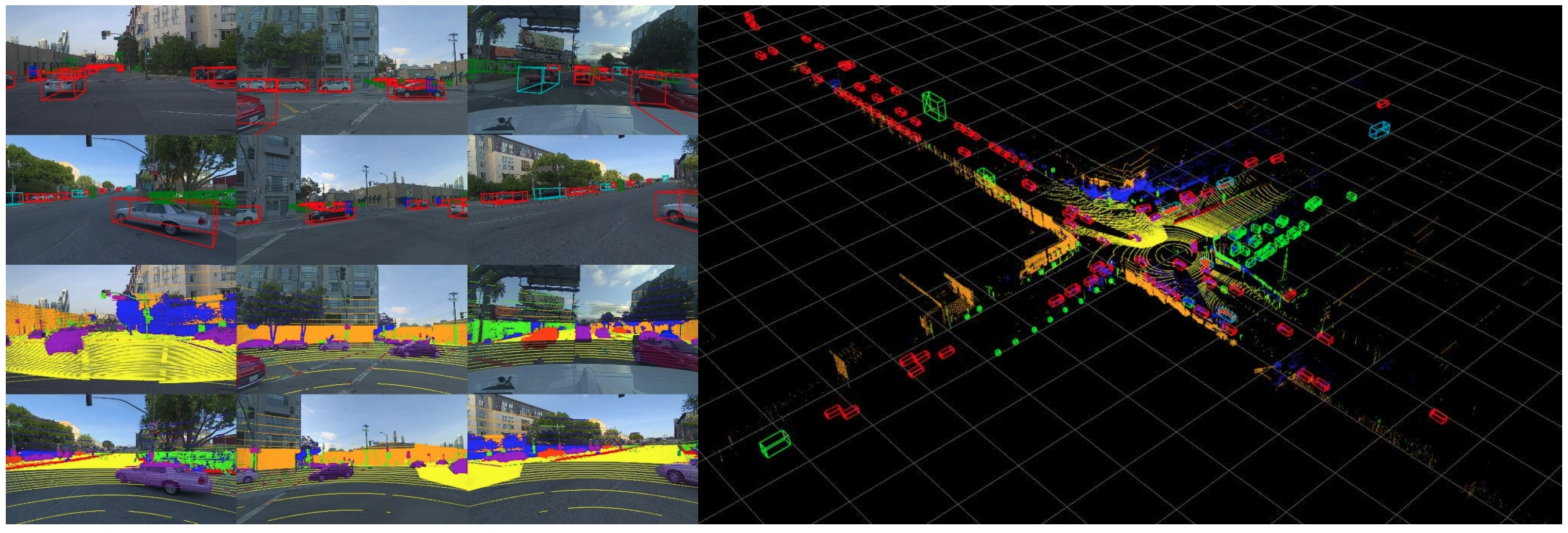
PandaSet Features
- 48,000+ camera images
- 16,000+ LiDAR sweeps
- 100+ scenes of 8s each
- 28 annotation classes
- 37 semantic segmentation labels
- Full sensor suite: 1x mechanical spinning LiDAR, 1x forward-facing LiDAR, 6x cameras, On-board GPS/IMU
How to Get and Convert PandaSet Data
Download
To download the dataset, please visit the official PandaSet webpage and sign up through the form. You will then be forwarded to a page with download links to the raw data and annotations.
Setup
- Clone the repository pandaset-devkit: https://github.com/basicai/pandaset-devkit
- Run in the python directory:
pip install -e .(Note: the command contains '.') - Run pandaset_basicai-cloud_convertor.py
- Execute command:
python pandaset_x1_convertor.py <pandaset/data/dir> <save/folder>
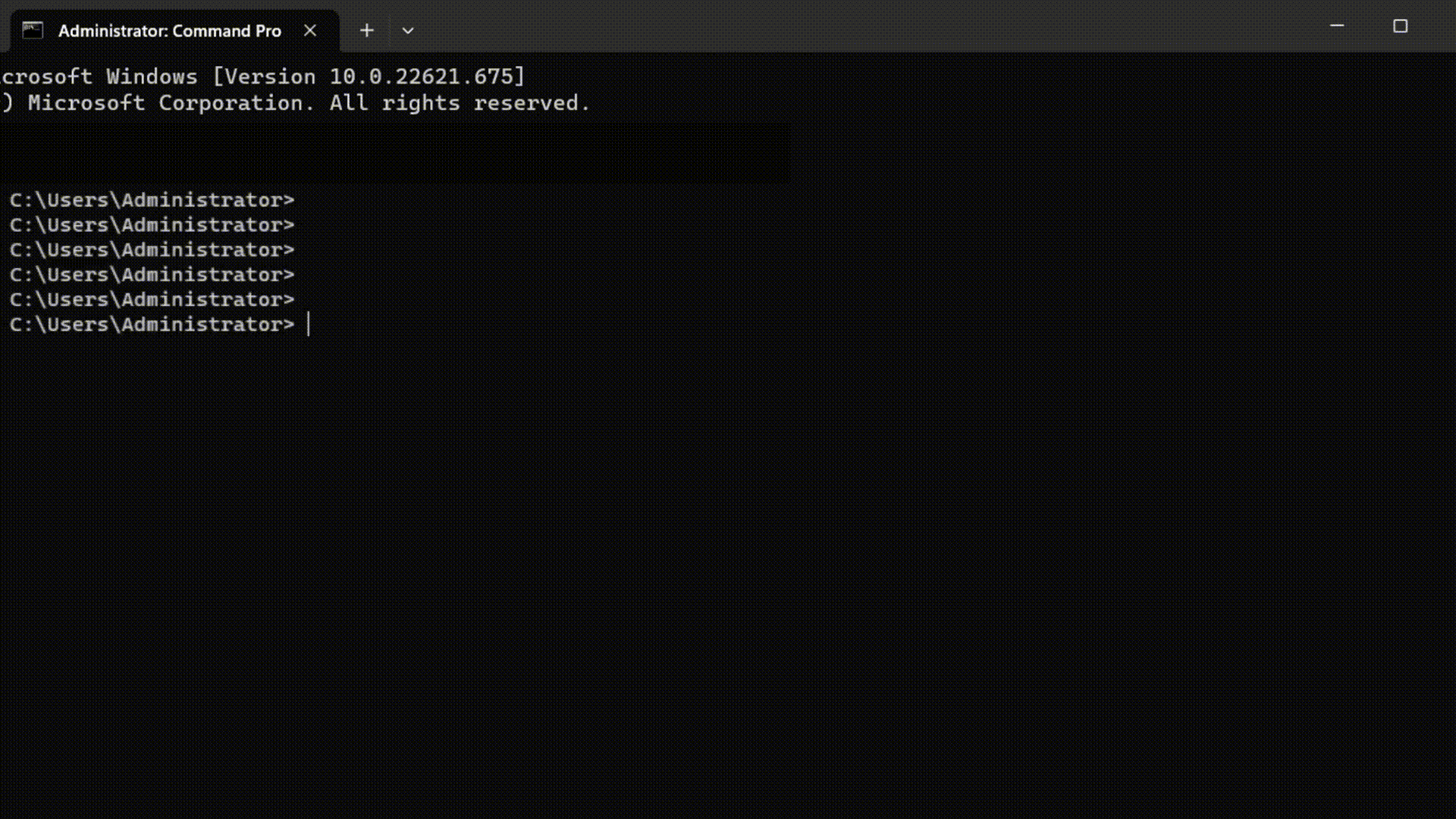
- An example:
python pandaset_x1_convertor.py C:\Users\Administrator\Desktop\pandaset\data C:\Users\Administrator\Desktop\pandaset\save --is_car_system=true
The first path is the data folder address of pandaset.The second is output data that meets the BasicAI Cloud data format requirement.There is an optional parameter at
is_car_system. If it istrue, the point cloud coordinate system will be established with the ego vehicle as the coordinate origin. The default isfalse(the world coordinate system).
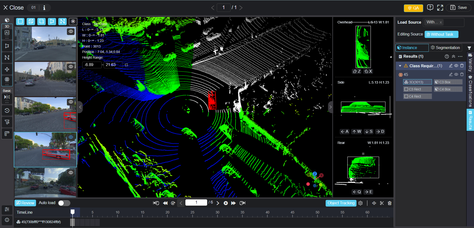
Upload Images to BasicAI Cloud
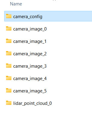
Converted data meets the BasicAI Cloud requirement:
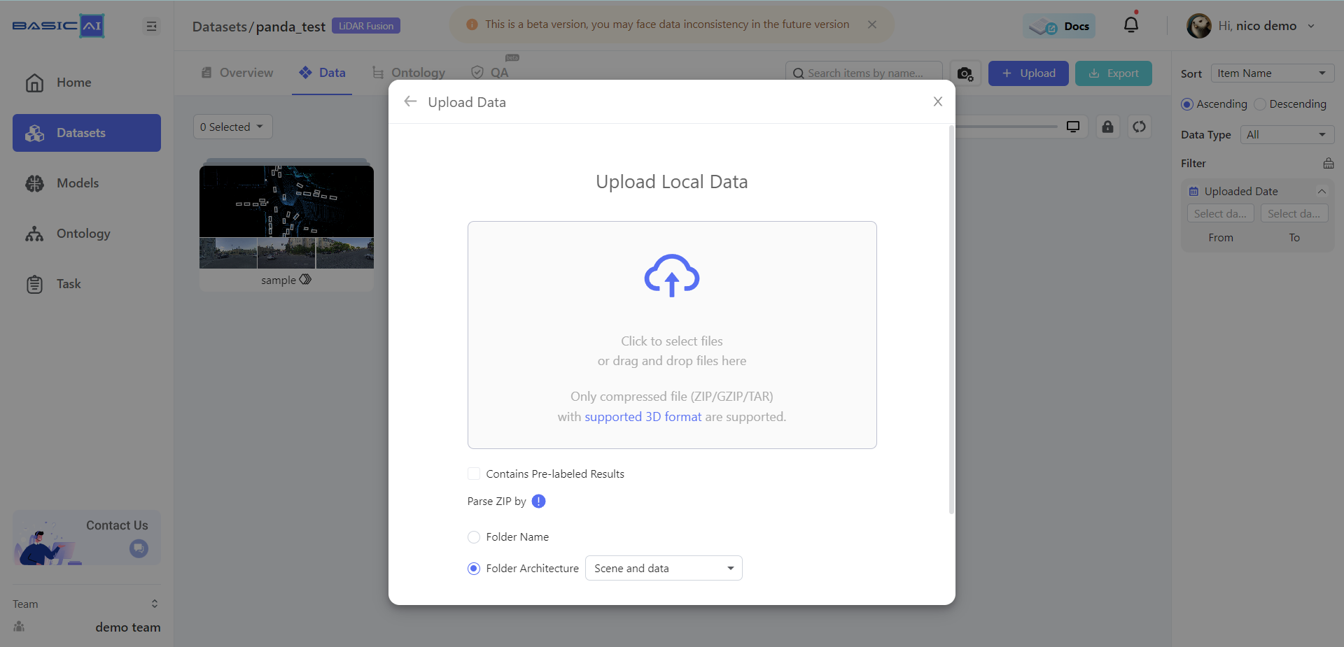
Compress and upload it to the platform. In the upload pop-up page, if the ·Scene and data· option is selected, the data can be grouped as a scene directly.
Finally, Lidar point cloud data, RGB camera data and camera parameter files are all set! You can start your project now!
Conclusion
PandaSet is an advanced sensor suite dataset for autonomous driving. The paper can be found at https://arxiv.org/abs/2112.12610.BasciAI emerges as an AI-driven company dedicated to streamlining data-related processes. Our vision is to facilitate the realization of a more cohesive and efficient AI ecosystem, where AI companies worldwide are connected with top-tier human intelligence through a dynamic AI-powered training data platform.
Frequently Asked Questions
Is Pandaset free to use?
Unless specifically labeled otherwise, these Datasets are provided to You under a Creative Commons Attribution 4.0 International Public License (“CC BY 4.0”), with the additional terms included in these Dataset Terms. The CC BY 4.0 may be accessed at https://creativecommons.org/licenses/by/4.0/. When You download or use the Datasets from the Website or elsewhere, You are agreeing to comply with the terms of CC BY 4.0. Where these Dataset Terms conflict with the terms of CC BY 4.0, these Dataset Terms will control.
Does 3D Lidar data annotation have a hosted web interface?
The hosted Xtreme1 (open source project) web interface is no longer officially supported, but you can register and login to BasicAI Cloud platform at https://app.basic.ai/#/login.
Updated about 1 year ago